Land for sale in Upper Corris, Machynlleth SY20, £150,000
150,000.00
Offer Nr.:
64102062
Type of ad:
for Sale
Property type:
Land
Contact name:
Lloyd Herbert & Jones
Phone(s):
01970 629017
Email:
* Freehold
* 10 5 acre block of amenity land
* Former Slate quarry
* Overground Tourist opportunities
* Good access off A487
* Backdrop for cylists bikers and ramblers
*Area of Stunning Natural Beauty
* Unique Tourism Opportunity
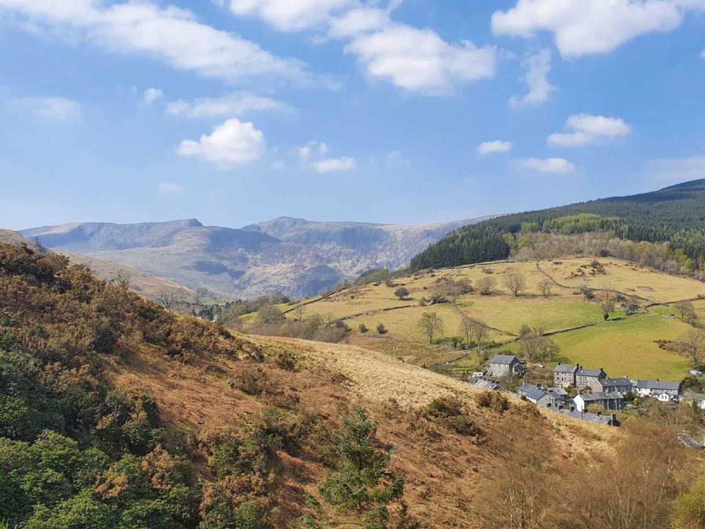
In an outstanding of natural beauty near Cadair Idris a unique Tourism
opportunity
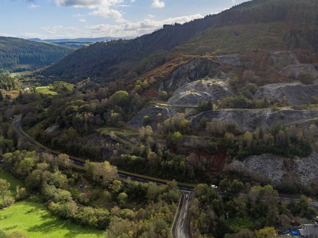
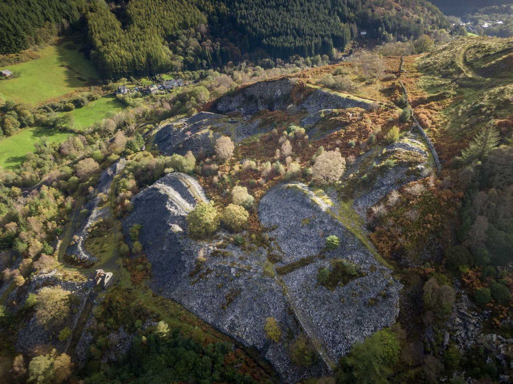
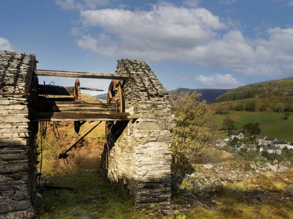
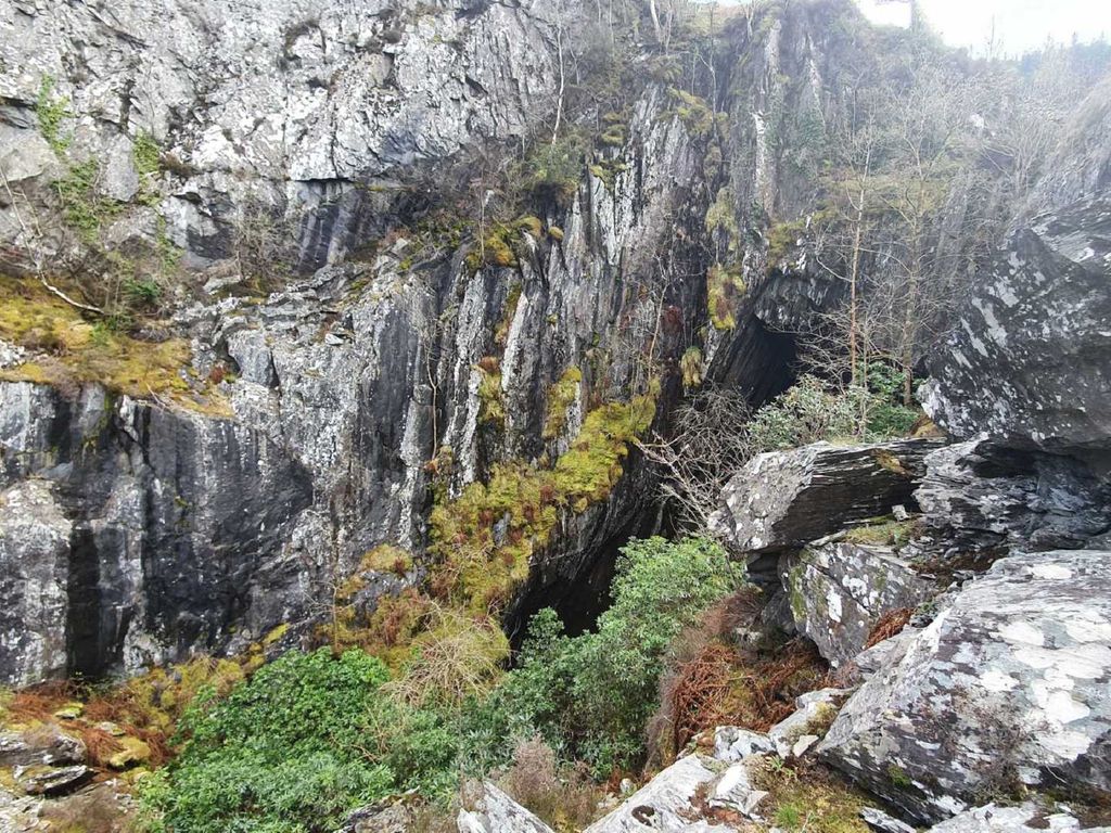
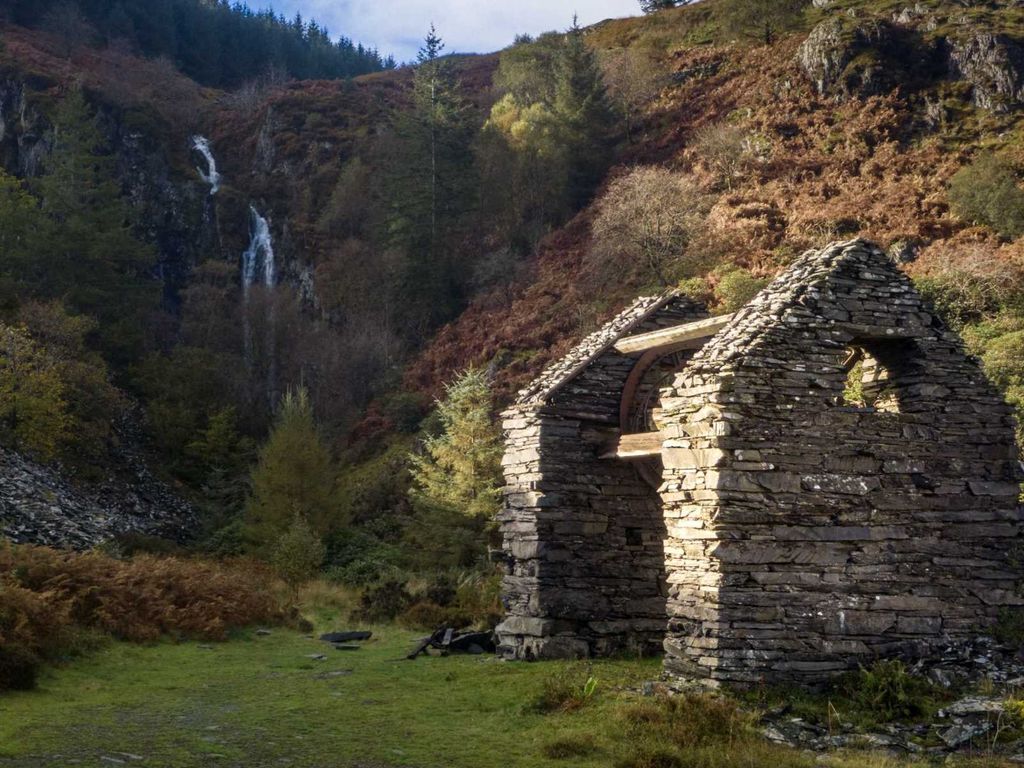
An attractive block ofamenity land on site of a former slate quarry
approximately 10. 5 acres of land with potential for diversification options.
The property affords Adventure Amenityopportunities overground.
The area being noted as fantastic backdrop for ramblers, cyclists and bikers,
Tourism is prime in the area being the gateway to Snowdonia andNorth Wales.
Local attractions include the neighbouring King Arthur's Labyrinth within the
village, The Centre for Alternative Technology, and Dyfi Osprey Projectwith
the vibrant market town of Machynlleth with Railway Station, some 6 miles and
Dolgellau 11 miles.
**Situation**
Corris is a popular location found 6 miles north ofthe historic town of
Machynlleth, the ancient capital of Wales, amd lies on the west bank of the
river Dulas, which here forms the county boundarybetween
Gwynedd/Merionethshire and Powys/Montgomeryshire, Powys being to the east of
the river.
The Afon Deri runs through the village before joining the Dulas. Themodern
A487 trunk road was built by the quarry owners in the 1840s and bypasses the
village.
The area is known for its natural history and for its industrial heritage.The
nearby Corris Craft Centre showcases the work of local craftspeople. Several
former slate mines penetrate the hillsides. Two miles south of Corris is the
Centre forAlternative Technology.
**Directions**
From Machynlleth pass over the Dyfi Bridge and proceed on the A470 for 6
miles. At Corris on the main A487, continue past the WarMemorial and Kings
Arthur Labrinyth. The access entrance to the site is above the road being the
next left after the "Food Shack" layby.
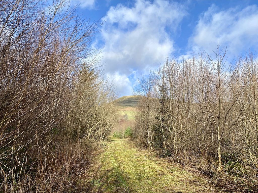
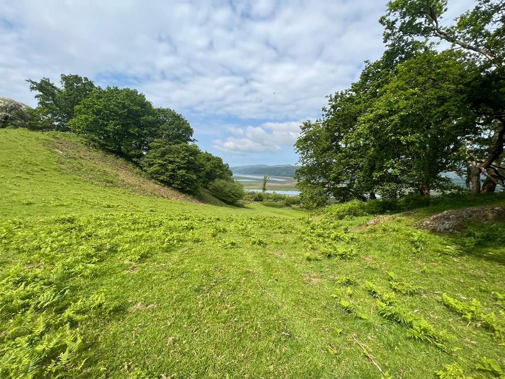
**The Site**
The property isaccessed from an inclined private track off the A487 trunk
road with rights of access There is a a fabulous aspect of mountain ranges
towards Cadair Idris from theproperty. This 10. 5 Acre site includes some
slate faces remaining on the terrain which produced slabs and roofing slate
that was exported all over the world.
**Opportunities**
Subject to planning consent from Gwynedd County Council, opportunities include
Overground Tourism experiences.
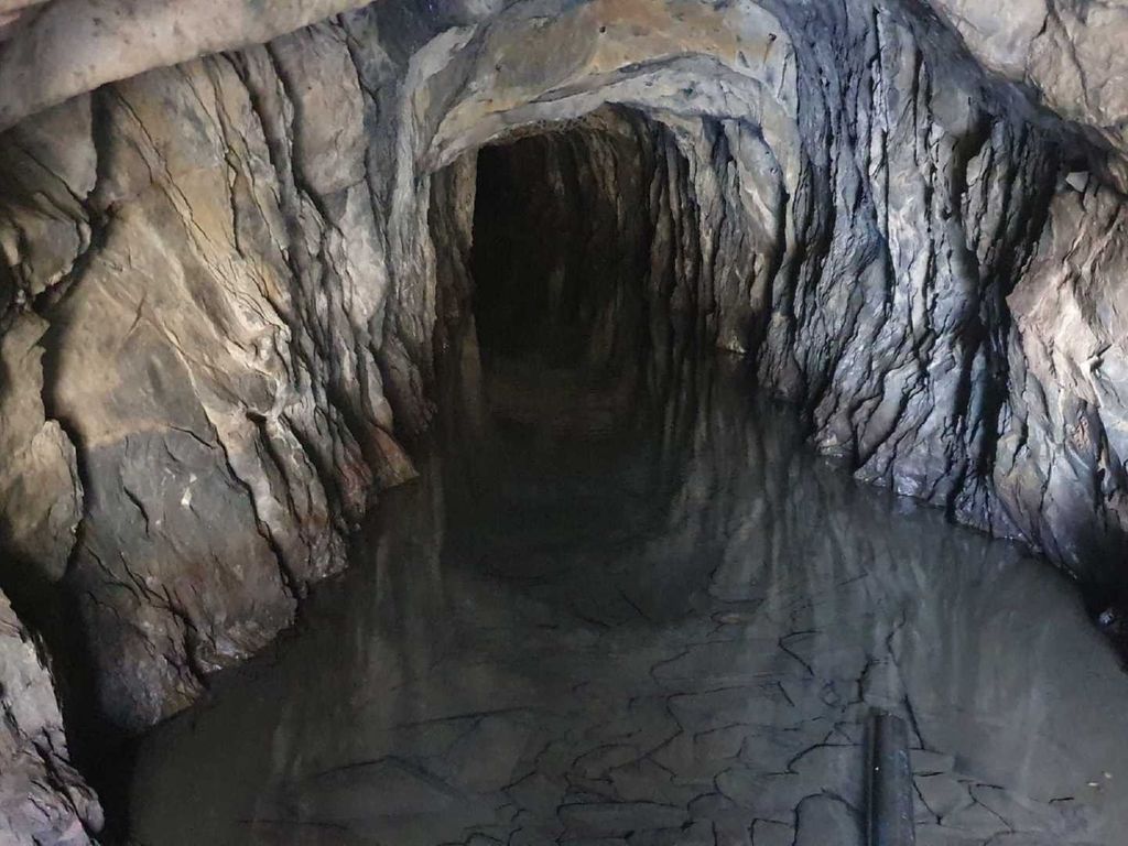
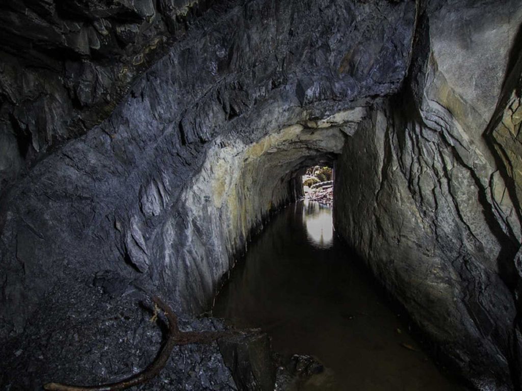
Previously the underground was used aspart of an outdoor pursuits centre for
teaching caving. Please note Mine and mineral rights are excepted. Subject to
an annual mine engineers inspection and insurancebacked this tourism line
could be continued.
**Money Laundering**
The successful purchaser will be required to produce adequate identification
to prove their identitywithin the terms of the Money Laundering Regulations.
Appropriate examples include: Passport/Photo Driving Licence and a recent
Utility Bill.
**ImportantInformation**
Whilst we endeavour to make our sales details accurate and reliable they
should not be relied on as statements or representations of fact and donot
constitute any part of an offer or contract. The seller does not make or give
nor do we or our employees have the authority to make or give any
representation orwarranty in relation to the property. Please contact the
office before viewing the property. If there is any point which is of
particular importance to you we will bepleased to check the information for
you and to confirm that the property remains available. This is particularly
important if you are contemplating travelling somedistance to view the
property.
**Notice**
Please note we have not tested any apparatus, fixtures, fittings, or services.
Interested parties must undertake their owninvestigation into the working
order of these items. All measurements are approximate and photographs
provided for guidance only.
* 10 5 acre block of amenity land
* Former Slate quarry
* Overground Tourist opportunities
* Good access off A487
* Backdrop for cylists bikers and ramblers
*
* Unique Tourism Opportunity
In an outstanding of natural beauty near Cadair Idris a unique Tourism
opportunity
An attractive block of
approximately 10. 5 acres of land with potential for diversification options.
The property affords Adventure Amenity
The area being noted as fantastic backdrop for ramblers, cyclists and bikers,
Tourism is prime in the area being the gateway to Snowdonia and
Local attractions include the neighbouring King Arthur's Labyrinth within the
village, The Centre for Alternative Technology, and Dyfi Osprey Project
the vibrant market town of Machynlleth with Railway Station, some 6 miles and
Dolgellau 11 miles.
**Situation**
Corris is a popular location found 6 miles north of
Machynlleth, the ancient capital of Wales, amd lies on the west bank of the
river Dulas, which here forms the county boundary
Gwynedd/Merionethshire and Powys/Montgomeryshire, Powys being to the east of
the river.
The Afon Deri runs through the village before joining the Dulas. The
A487 trunk road was built by the quarry owners in the 1840s and bypasses the
village.
The area is known for its natural history and for its industrial heritage.
nearby Corris Craft Centre showcases the work of local craftspeople. Several
former slate mines penetrate the hillsides. Two miles south of Corris is the
Centre for
**Directions**
From Machynlleth pass over the Dyfi Bridge and proceed on the A470 for 6
miles. At Corris on the main A487, continue past the War
Arthur Labrinyth. The access entrance to the site is above the road being the
next left after the "Food Shack" layby.
**The Site**
The property is
road with rights of access There is a a fabulous aspect of mountain ranges
towards Cadair Idris from the
slate faces remaining on the terrain which produced slabs and roofing slate
that was exported all over the world.
**Opportunities**
Subject to planning consent from Gwynedd County Council, opportunities include
Overground Tourism experiences.
Previously the underground was used as
teaching caving. Please note Mine and mineral rights are excepted. Subject to
an annual mine engineers inspection and insurance
could be continued.
**Money Laundering**
The successful purchaser will be required to produce adequate identification
to prove their identity
Appropriate examples include: Passport/Photo Driving Licence and a recent
Utility Bill.
**Important
Whilst we endeavour to make our sales details accurate and reliable they
should not be relied on as statements or representations of fact and do
constitute any part of an offer or contract. The seller does not make or give
nor do we or our employees have the authority to make or give any
representation or
office before viewing the property. If there is any point which is of
particular importance to you we will be
you and to confirm that the property remains available. This is particularly
important if you are contemplating travelling some
property.
**Notice**
Please note we have not tested any apparatus, fixtures, fittings, or services.
Interested parties must undertake their own
order of these items. All measurements are approximate and photographs
provided for guidance only.
Property location on the map: Use mouse double click to (Zoom IN: LEFT button; Zoom OUT: RIGHT button)