Land for sale in Heol Y Maerdy, Ffairfach, Llandeilo SA19, £125,000
125,000.00
Offer Nr.:
59727285
Type of ad:
for Sale
Property type:
Land
Contact name:
Gerald R Vaughan
Phone(s):
01267 312975
Email:
* Freehold
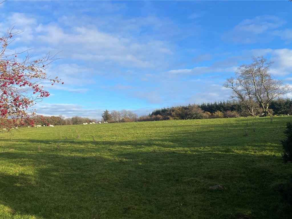
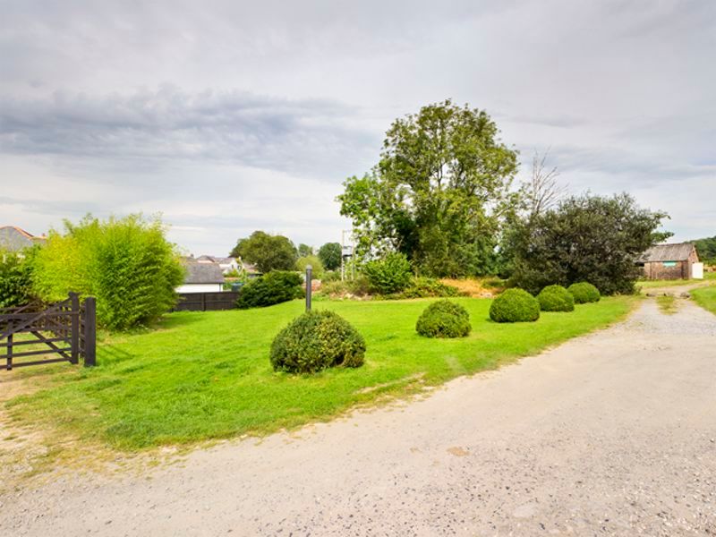
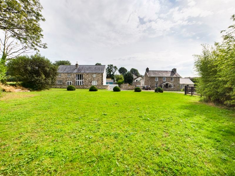
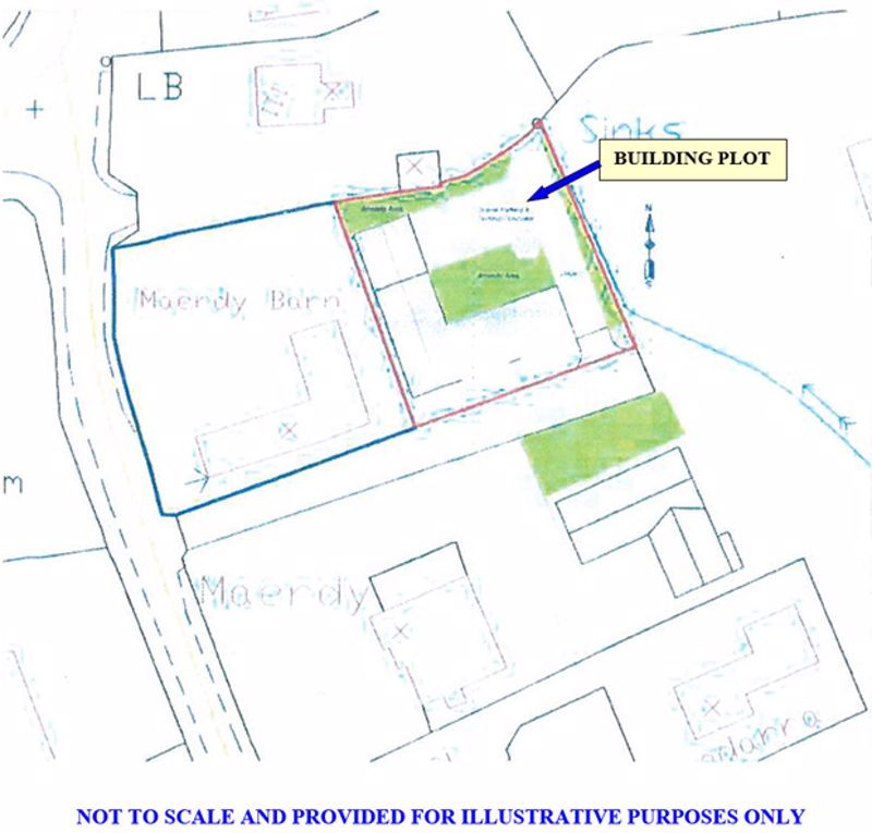
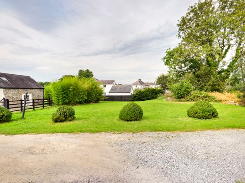
* Freehold individual residential building plot.
* Frontage 28 metres. Average depth 26 metres.
* Sought after area. Semi rural location.
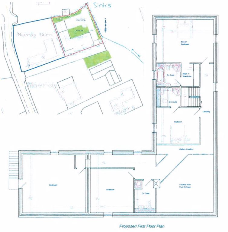
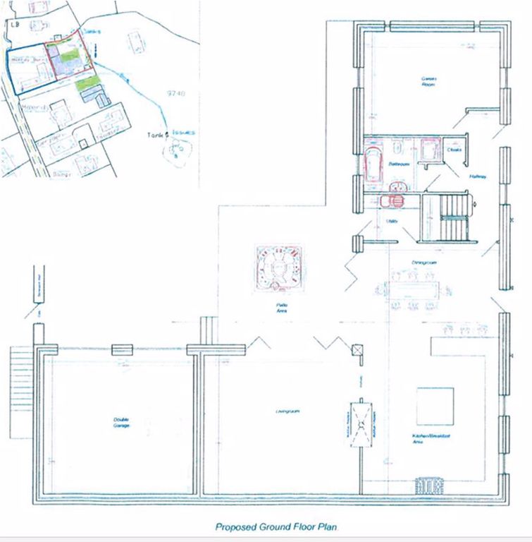
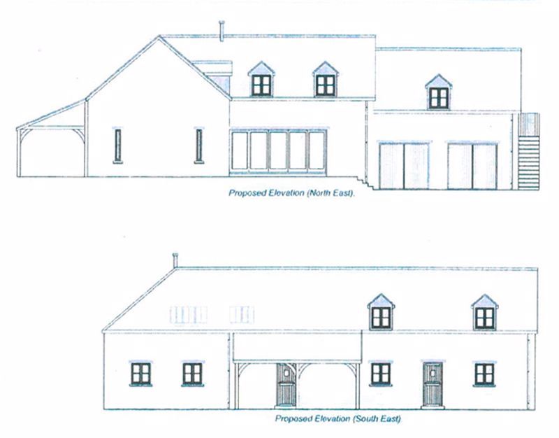
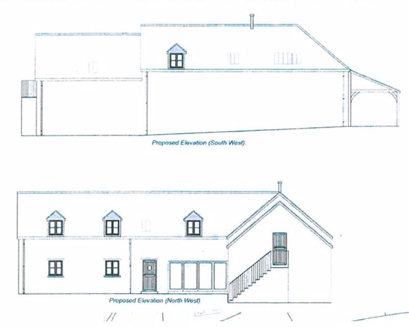
* Full planningpermission for the siting of A double storey dwelling.
* Just off A483 llandeilo to ammanford road.
* Walking distance ffairfach train station.
* 1 mile llandeilo towncentre.
* Cables/pipes for mains electricty water and drainage have been brought to the plot but have not been connected.
* Planning dept. Will entertain A smallersized dwelling that would not affect the exemption for affordable housing contribution.
* No affording housing provision payment.
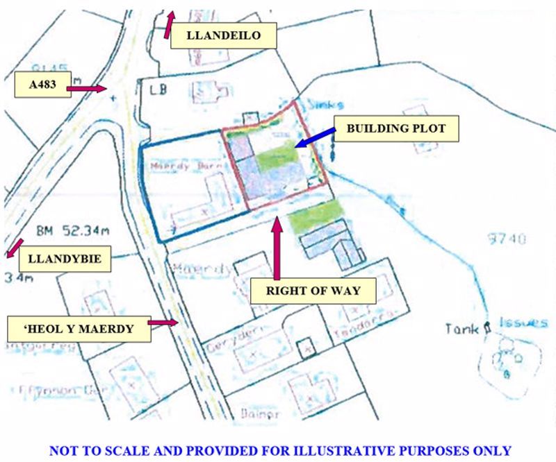
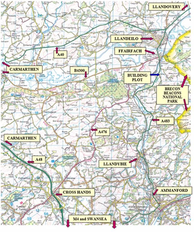
A most conveniently situatedindividual freehold residential building plot
enjoying a semi rural position just off 'Heol y Maerdy' and the A483 Llandeilo
to Ammanford road (regular bus route) on theperiphery of the village of
Ffairfach which in turn lies on the A483 Llandeilo to Ammanford road within
half a mile of Ffairfach Train Station and approximately 1 mile ofLlandeilo
Town Centre. The plot being located within 3. 5 miles of Llandybie, is within
5. 5 miles of Ammanford, is within 8 miles of Cross Hands and the A48dual
carriageway, is within 10 miles of the M4 Motorway and is located some 15
miles east of the County and Market Town of Carmarthen. The plot being located
just outsideThe Brecon Beacons National Park.
Planning permission: - Full Planning Permission for the siting of a new double
storey dwelling was granted on the 19th June 2010 underPlanning Reference No.
E/22708.
Carmarthenshire County Council Planning Services Dept. Confirmed on the 22nd
July 2015 that a 'Technical Start' in Planning Terms hadbeen made on the site
and as such the Planning Permission in its present form would have been
safeguarded in perpetuity. A copy of the Planning Permission etc areavailable
of the Agents Offices or alternatively interested applicants may view the
Planning Permission in favour of the site by visiting and by accessing the
Planningportal section and entering the Planning Reference E/22708 in the
search box.
* Freehold individual residential building plot.
* Frontage 28 metres. Average depth 26 metres.
* Sought after area. Semi rural location.
* Full planning
* Just off A483 llandeilo to ammanford road.
* Walking distance ffairfach train station.
* 1 mile llandeilo town
* Cables/pipes for mains electricty water and drainage have been brought to the plot but have not been connected.
* Planning dept. Will entertain A smaller
* No affording housing provision payment.
A most conveniently situated
enjoying a semi rural position just off 'Heol y Maerdy' and the A483 Llandeilo
to Ammanford road (regular bus route) on the
Ffairfach which in turn lies on the A483 Llandeilo to Ammanford road within
half a mile of Ffairfach Train Station and approximately 1 mile of
Town Centre. The plot being located within 3. 5 miles of Llandybie, is within
5. 5 miles of Ammanford, is within 8 miles of Cross Hands and the A48
carriageway, is within 10 miles of the M4 Motorway and is located some 15
miles east of the County and Market Town of Carmarthen. The plot being located
just outside
Planning permission: - Full Planning Permission for the siting of a new double
storey dwelling was granted on the 19th June 2010 under
E/22708.
Carmarthenshire County Council Planning Services Dept. Confirmed on the 22nd
July 2015 that a 'Technical Start' in Planning Terms had
and as such the Planning Permission in its present form would have been
safeguarded in perpetuity. A copy of the Planning Permission etc are
of the Agents Offices or alternatively interested applicants may view the
Planning Permission in favour of the site by visiting and by accessing the
Planning
search box.
Property location on the map: Use mouse double click to (Zoom IN: LEFT button; Zoom OUT: RIGHT button)