Land for sale in Heol Cwmbach, Drefach, Llanelli SA14, £130,000
130,000.00
Offer Nr.:
54225695
Type of ad:
for Sale
Property type:
Land
Contact name:
Gerald R Vaughan
Phone(s):
01267 312975
Email:
* Freehold
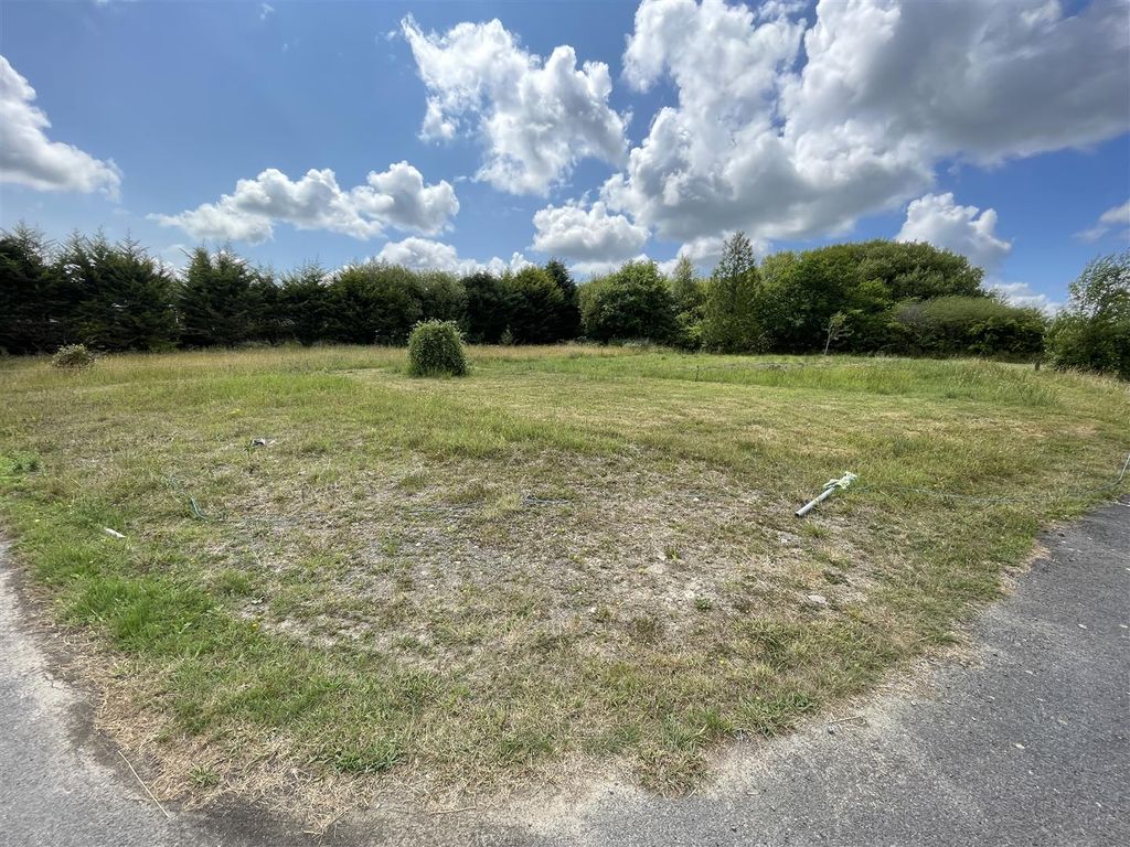
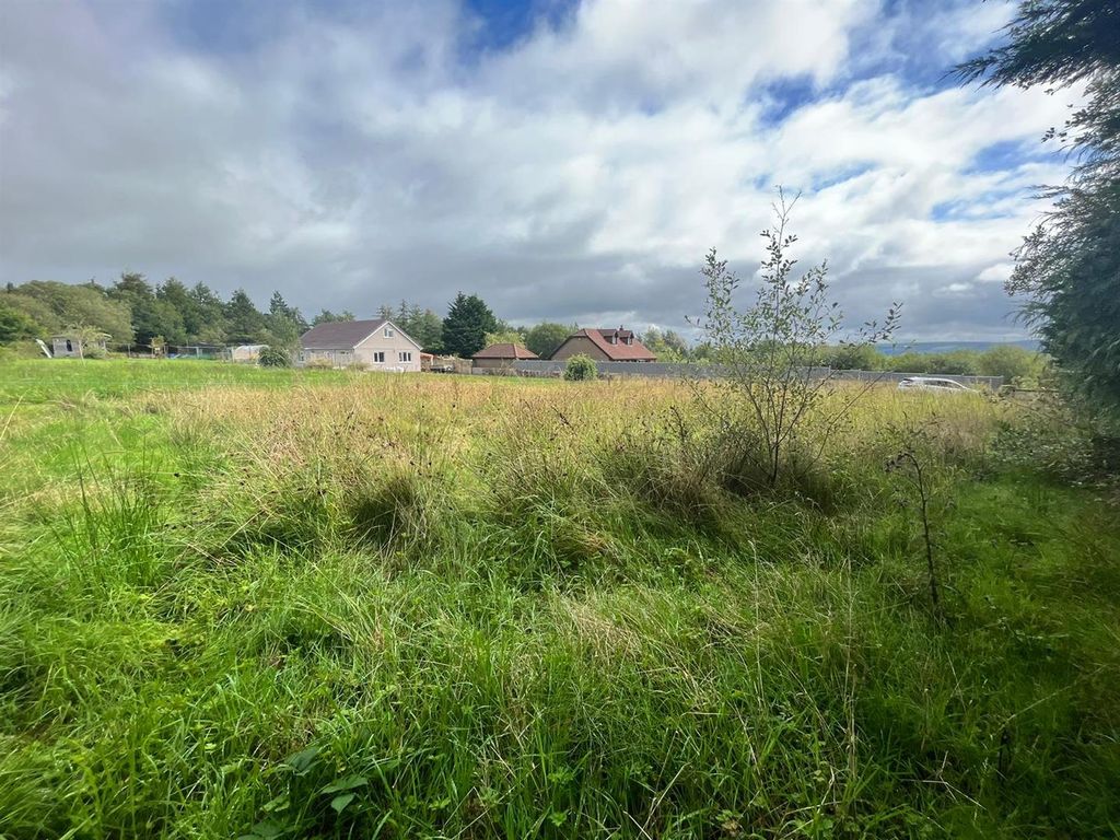
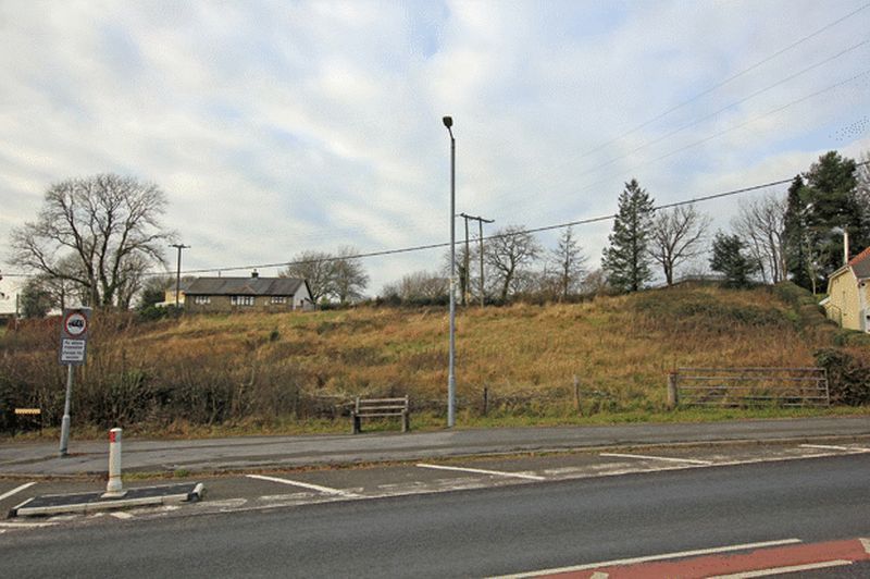
* Freehold residential development site.
* Outline planning permission for the siting of 4 detached houses.
* Site area - 0. 85 of an acre (0. 345ha).
*South facing site with good road frontage.
* Walking distance centre of drefach.
* 3 miles cross hands. 8 milesd llanelli.
* 9 miles south of carmarthen.
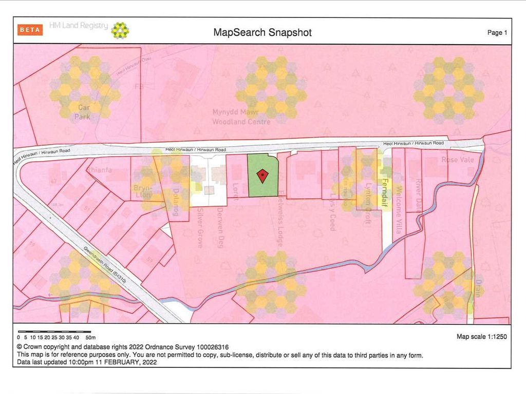
A mostconveniently situated freehold residential development site having the
benefit of Outline Planning Permission for the siting of 4 detached dwelling
houses situateoccupying a site with an overall area amounting to
approximately 0. 85 of an Acre (0. 345ha) being located set back off and above
the road overlooking 'Heol Cwmmawr/HeolCwmbach' and the hamlet of Cwmmawr
within walking distance of the centre of Drefach that offers a thriving
Primary School and Petrol Filling Station/Mini Market/Sub PostOffice
approximately 3 miles of Cross Hands and the A48 dual carriageway, some 9
miles south - east of the County and Market town of Carmarthen and approximately
8 milesof the town of Llanelli.
The site is located fronting onto 'Heol Cwmbach/Heol Cwmmawr' that leads from
Drefach to Tumble within walking distance of Drefach CountyPrimary School and
the Petrol Filling Station/Mini Market/Sub Post Office at Drefach that are
approximately half a mile distant. The site enjoys ease of access to theA48
dual carriageway and Business Park at Cross Hands (3 miles) with the M4
Motorway being some 7 miles distant and the towns of Carmarthen and Llanelli
being 9 and 8miles distant respectively.
Site Dimensions: -
Overall Site Area 3450 Sq. M (0. 345ha) - 0. 85 of an Acre.
Frontage to Heol Cwmbach/Heol Cwmmawr: - Approx 200ft.Average Depth: - 165ft.
Average Width through the middle of the site: - 235ft. All dimensions mentioned
in these particulars are approximate having been taken fromthe
Architect/Planning Consultants Drawings supplied to the Vendors and therefore
prospective purchasers should satisfy themselves as to the accuracy of the
same prior toagreeing to purchase the land.
Please note that rear north - western boundary of the development land is
located approximately 8m off the rear elevation wall of thedwelling known as
'Ynysdawela'.
Planning Permission : - Outline planning permission for the siting of a 4 No.
Detached Dwelling Houses was granted on the 29th June 2017under Planning
Reference No W/34603. A copy of the planning permission is obtainable from the
Agents Offices or by visiting and by searching Planning Applications underthe
Planning Portal and inserting the Application No - W/34603. Note - Under
planning Reference No: W W/40801 the validity for the submission of Approval
of ReservedMatters was extended by a further 3 years. Note: The Planning
Consent is subject to a unilateral undertaking between the Landowner and
Carmarthenshire County Council togive effect to a commitment for a financial
contribution which equates to £40. 48p per Square Metre of internal floor space
towards the provision of affordable housingin accordance with Policy AH1 of
the Carmarthenshire ldp.
* Freehold residential development site.
* Outline planning permission for the siting of 4 detached houses.
* Site area - 0. 85 of an acre (0. 345ha).
*
* Walking distance centre of drefach.
* 3 miles cross hands. 8 milesd llanelli.
* 9 miles south of carmarthen.
A most
benefit of Outline Planning Permission for the siting of 4 detached dwelling
houses situate
approximately 0. 85 of an Acre (0. 345ha) being located set back off and above
the road overlooking 'Heol Cwmmawr/Heol
within walking distance of the centre of Drefach that offers a thriving
Primary School and Petrol Filling Station/Mini Market/Sub Post
approximately 3 miles of Cross Hands and the A48 dual carriageway, some 9
miles south - east of the County and Market town of Carmarthen and approximately
8 miles
The site is located fronting onto 'Heol Cwmbach/Heol Cwmmawr' that leads from
Drefach to Tumble within walking distance of Drefach County
the Petrol Filling Station/Mini Market/Sub Post Office at Drefach that are
approximately half a mile distant. The site enjoys ease of access to the
dual carriageway and Business Park at Cross Hands (3 miles) with the M4
Motorway being some 7 miles distant and the towns of Carmarthen and Llanelli
being 9 and 8
Site Dimensions: -
Overall Site Area 3450 Sq. M (0. 345ha) - 0. 85 of an Acre.
Frontage to Heol Cwmbach/Heol Cwmmawr: - Approx 200ft.
Average Width through the middle of the site: - 235ft. All dimensions mentioned
in these particulars are approximate having been taken from
Architect/Planning Consultants Drawings supplied to the Vendors and therefore
prospective purchasers should satisfy themselves as to the accuracy of the
same prior to
Please note that rear north - western boundary of the development land is
located approximately 8m off the rear elevation wall of the
'Ynysdawela'.
Planning Permission : - Outline planning permission for the siting of a 4 No.
Detached Dwelling Houses was granted on the 29th June 2017
Reference No W/34603. A copy of the planning permission is obtainable from the
Agents Offices or by visiting and by searching Planning Applications under
Planning Portal and inserting the Application No - W/34603. Note - Under
planning Reference No: W W/40801 the validity for the submission of Approval
of Reserved
Consent is subject to a unilateral undertaking between the Landowner and
Carmarthenshire County Council to
contribution which equates to £40. 48p per Square Metre of internal floor space
towards the provision of affordable housing
the Carmarthenshire ldp.
Property location on the map: Use mouse double click to (Zoom IN: LEFT button; Zoom OUT: RIGHT button)
Similar properties: